Hello Flusianer

Hmmm, ein Entwickler der mir pesrönlich unbekannt ist, hat da ein interessantes Tool auf den Markt gebracht.

Es handelt sich um
SimPlates X, so eine Art Konkurenzprodukt zu den Jeppesen SimCharts.
Interessant ist, dass "SimPlates X" mit folgenden Flugsimulatoren kompatibel ist:
MSFS x, 2004, 2002 und vorhergehenden Versionen. Weiterhin mit x-Plane, Elite, ASA On top, und und und ....!
Hier mal ein paar Screenie´s:
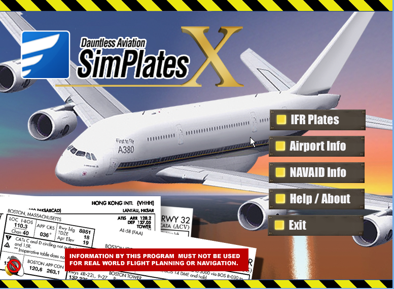
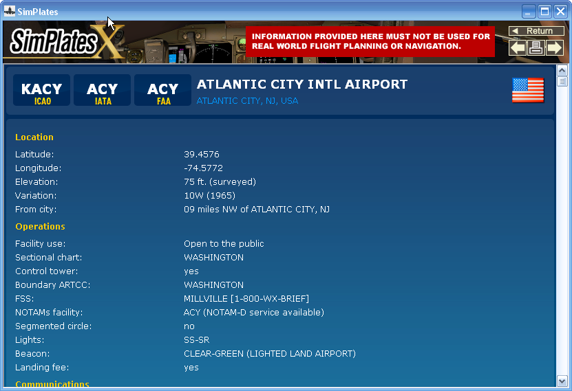
SimPlates X (the "X" is to equate it roughly, timewise, with Microsoft's Flight Simulator X) is our collection of IFR approach (and other) charts and a worldwide airport/facility directory aimed at the serious flight simulation enthusiast. This latest edition (SimPlates 2000 and 2004 came before) features over 30,000 REAL WORLD IFR PLATES - far more plates and at a higher quality than ever before.
Take your flight simulator experience to the next level!
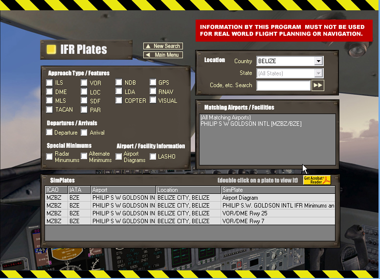
Over 30,000 real-world IFR plates, including approach plates, SIDs/STARs, Airport Diagrams, and more. Approach types include ILS, VOR, VOR/DME, NDB, LLZ, SDF, GPS, TACAN, Helicopter, Visual, and more.
Superb coverage: includes virtually every IFR plate for the USA and plates for hundreds of countries worldwide.
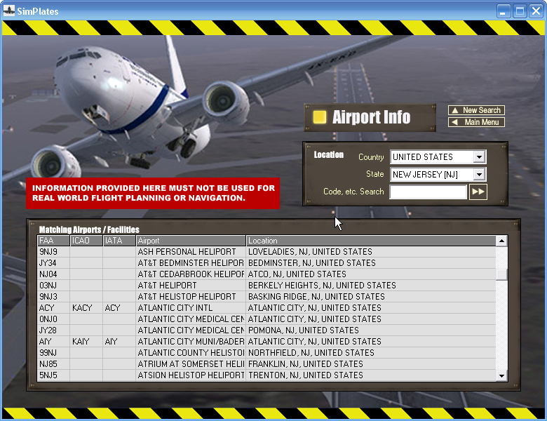
Complete, Integrated WORLDWIDE Airport/Facilities directory. Features useful information on the vast majority of the world's airports, including many tens of thousands without instrument approaches. Also included as part of this is a fairly comprehensive worldwide directory of NAVAIDs (Navigational Aids) such as VORs and NDBs.
For the USA, a complete list of preferred routing tables is included, so you can plan your virtual flights just like the pros do!
This is a massive collection of data, totaling over 6gb - which is actually too much for a 'standard' DVD. In fact, we've had to go to a special larger-capacity DVD format to fit it all on!
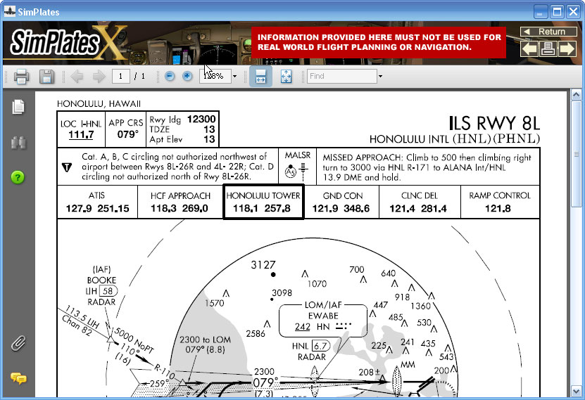
Simplates' friendly interface makes it easy to find exactly the plate or information you are looking for quickly, print it out, and have it ready for your virtual flight. Yes, SimPlates are meant to be printed, not viewed on screen (though it is theoretically possible to view them on-screen as well, as they come as PDF files, you will in practice find it easier to do as real pilots do and print them out to reference while you are simming).
SimPlates X is available now via download - both as a demo and the whole thing for purchase. Additionally, if you don't think you want want to download around 6gb, you can pre-order the DVD, which we expect to ship (worldwide!) around the end of September.
Remember, SimPlates are ACTUAL IFR PLATES! However, pilots, please avoid all temptation and DO NOT USE THEM FOR REAL WORLD FLIGHT. This is because actual IFR plates have relatively short life spans, and thus the plates in SimPlates should be considered expired. However, they are still more than perfectly valid for simulator flying.
Gut auch, dass man dieses Add On erst einmal kostenlos testen kann!

Schaut einfach mal vorbei:
Dauntless
:skol:


